
Civil Engineering
- Municipal Infrastructure Design
- Land Development Services
- Construction Management & Observation
- Road Design & Traffic Analysis
- Water Supply, Distribution & Treatment
- Wastewater Collection & Treatment
- Storm Water Drainage & Flood Control
- Site Grading
- Revegetation & Erosion Control
- Land Use Constraint Mapping
- Dams & Reservoirs
- Groundwater
- Irrigation Systems
- Solid Waste & Environmental Services
Surveying
- Aerial Mapping Control
- ALTA/ASCM Survey
- As-Built Survey
- Construction Surveying
- Easement & Right-of-Way Survey
- Improvement Location Certificate
- Mining Survey
- Monument Establishment, Restoration & Rehabilitation
- Property Boundary Survey
- Property Improvement Survey
- Subdivision Surveying
- Topographic Survey
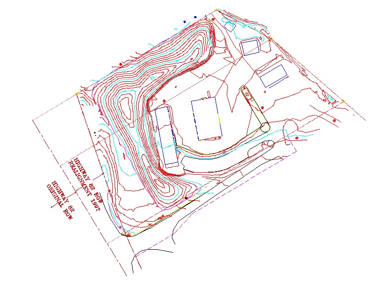
What Is A Topographic Survey:
A topographic survey, also known as a land survey or a ground survey, shows the shape of the land. It uses contour lines, a line that represents a specific elevation measured from Mean Sea Level, to display the three dimensional features of the property onto a two dimensional surface. A topographic survey includes both natural and man-made features. It's common to show hills, streams, lakes, and vegetation along with major buildings, fences, roads, transmission lines, and property boundaries on a topographic survey. The difference between a topographic survey and it's cousin, the topographic map, is that a survey shows more detail for a smaller area than a map. A topographic survey is used for a variety of uses including planning and zoning, site layout, engineering and architectural design, and construction.
More Information:
- The U.S. Geological Survey, responsible for providing the nation with topographic maps, provides a wonderful website concerning these maps.
- Surveyors use a benchmark with a known elevation in establishing the contour lines of a topographic survey. The Hawaiian Volcano Observatory has a nice article describing benchmarks and their uses
Consulting Engineers & Land Surveyors
113 Ninth Street, Suite 214
Last Modification: April 20 2005