
Surveying
Civil Engineering
- Municipal Infrastructure Design
- Land Development Services
- Construction Management & Observation
- Road Design & Traffic Analysis
- Water Supply, Distribution & Treatment
- Wastewater Collection & Treatment
- Storm Water Drainage & Flood Control
- Site Grading
- Revegetation & Erosion Control
- Land Use Constraint Mapping
- Dams & Reservoirs
- Groundwater
- Irrigation Systems
- Solid Waste & Environmental Services
Surveying
- Aerial Mapping Control
- ALTA/ASCM Survey
- As-Built Survey
- Construction Surveying
- Easement & Right-of-Way Survey
- Improvement Location Certificate
- Mining Survey
- Monument Establishment, Restoration & Rehabilitation
- Property Boundary Survey
- Property Improvement Survey
- Subdivision Surveying
- Topographic Survey
Surveying Definitions:
Merriam-Webster's Collegiate Dictionary defines surveying as "a branch of applied mathematics that teaches the art of determining the area of any portion of the earth's surface, the lengths and directions of the bounding lines, and the contour of the surface and of accurately delineating the whole on paper".
The Colorado Revised Statues defines Professional land surveying as "the application of special knowledge of principles of mathematics, methods of measurement, and law for the determination and preservation of land boundaries . . . including restoration and rehabilitation of corners and boundaries in the united states (sic) public land survey system; obtaining and evaluating boundary evidence; determination of the areas and elevations of land parcels; measuring and platting underground mine workings; preparation of the boundary control portions of geographic and land information systems; establishment, restoration, and rehabilitation of land survey monuments and survey reports; surveying monuments and platting of easements and rights-of-ways; and geodetic surveying."
What a Surveyor Does:
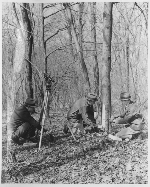
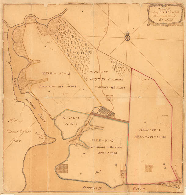
A surveyor travels to the property and analyzes it with respect to it's surroundings. Most of the time, he will use equipment to measure the distances of various objects on the property, research the county courthouse for legal descriptions and recorded drawings of the property, interprets the data, and draws a sketch of the property on a sheet of paper. While geometry and trigonometry are important knowledge for a surveyor, he also must be fluent in the local laws and court rulings concerning property transactions and rights.
The survey that the surveyor produces, while highly accurate, is considered as an approximation of the property's boundary and it's topography in the court system. A surveyor does not grant land, only the courts can grant land to an individual, but the surveyor's knowledge of the property is used by the courts in determining the property's boundary.
The Art of Surveying:
According to Wilhelm Schmidt in an article printed in Professional Surveying Magazine, surveying is an art because it is a process of making something while using instruments. The surveyor's instruments are his mathematical knowledge of geometry and trigonometry along with the electronic measuring devices, chains, and compasses to produce a survey of the property. A surveyor learns the mathematical principles under the sterilized, textbook world of a university and then apply his knowledge to the real world where nothing corresponds to the standard "rules" learned in school.
Schmidt believes that the artistic part of surveying lies in the surveyor's decisions in choosing the equipment, mathematical principles, past surveys, and legal descriptions to achieve a high degree of accuracy while making sense out the chaos of life. A surveyor must deal with monuments located in the wrong place or destroyed. He must make decisions based on unreadable plats or recorded legal descriptions with typographical or mathematical errors while basing his survey on a fence line that may or may not of moved since the last survey of the property in the early 1900's. Surveying is very much an art based on the interpretation of historical fact.
Global Positioning Satellites (GPS):
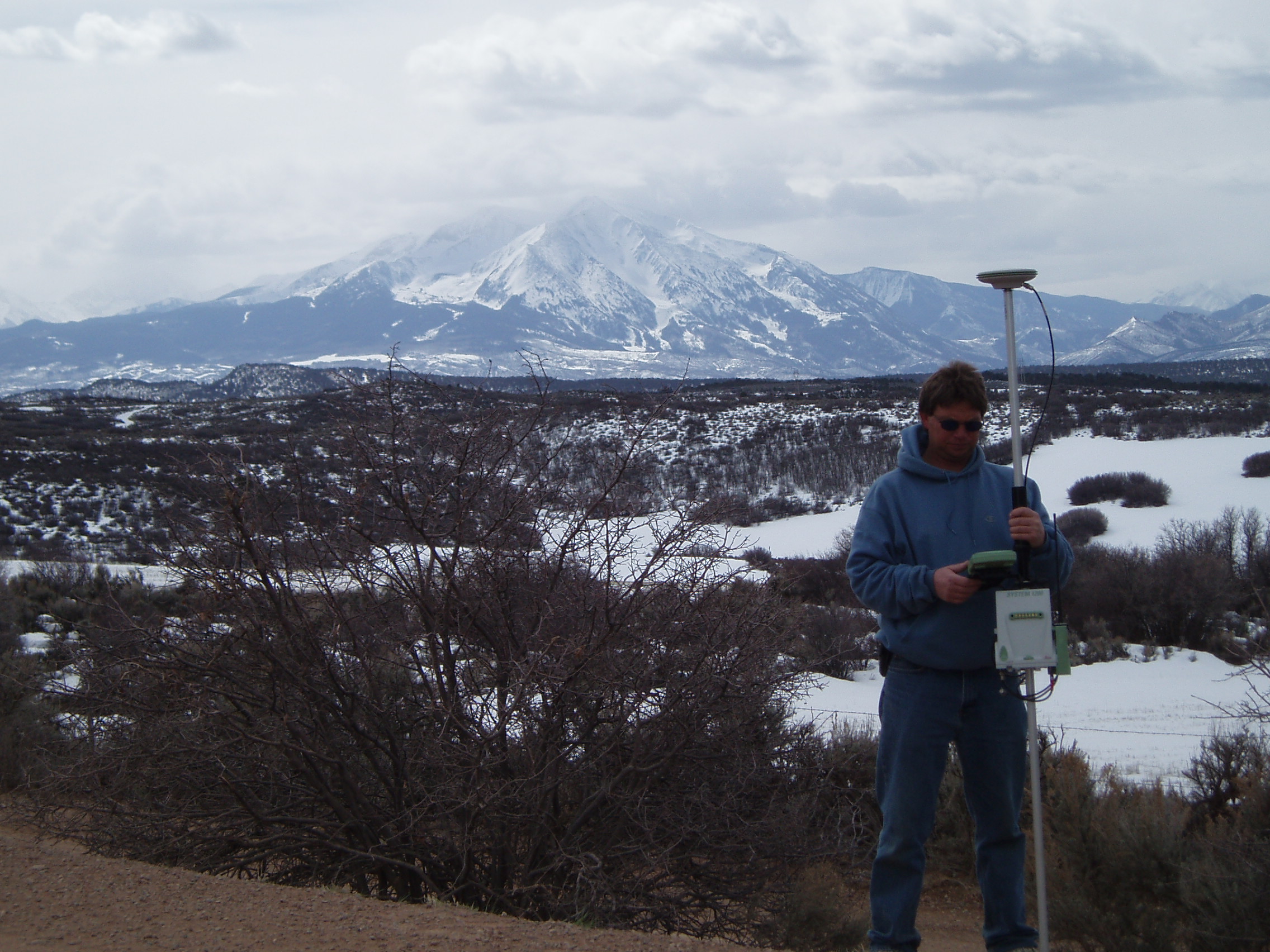
GPS (Global Positioning Satellites) is quickly becoming one of the more frequently used surveying instruments today. With GPS, a surveyor can cover more ground in less time than more conventional methods. However, there are risks associated with GPS if not used correctly.
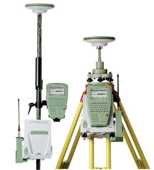
Gamba and Associates, like most surveyors who use global positioning satellites, rely primarily on differential GPS for our GPS surveying needs. Differential GPS uses a base receiver at a known and previously checked control point, often a government monument, and a roaming receiver or rover. The base receiver and rover record concurrent satellite data which is used to determine the rover's position relative to the base. The base and the rover are connected via a radio modem allowing instant access to location information at the rover.
GPS accuracy is dependent on numerous factors including tree canopy, number of satellites available to the receiver, and ionosphere and sun spot activity, but the average accuracy of differential GPS is 1 cm (0.394 inches) plus 1 ppm for horizontal measurements and 2 cm (0.787 inches) plus 1 ppm for vertical measurements. It should be noted that these accuracies are only achieved with survey level differential GPS units and not a common hand held unit purchased at the store. The documentation accompanying the hand held unit should address the accuracies of that particular unit.
As mentioned above, GPS surveying has to be used correctly and is sometimes limited in it's application. Since GPS surveying relies on the ability to use satellites, one must be able to "see" enough of the sky to collect data from a minimum of four satellites at the same time. Areas with dense overhead vegetation (i.e. trees) or with steep adjacent hillsides, all of which block the view of the sky, often are not suitable areas for GPS surveying and other techniques must be utilized.
GPS Related Links:
- The Geographer's Craft at the University of Colorado is an in-depth overview of Global Positioning System.
- Sam Wormley maintains another great site relating to GPS.
- The United States Coast Guard maintains a Global Positioning System (GPS) website.
- NASA's J-Track satellite displays the movement of all satellites on a real-time basis. Beware, this site requires a high-speed connection with a fast computer.
Professional Surveying Societies:
- The Colorado State Board of Registration for Professional Engineers and Land Surveyors is responsible for licensing and governing the use of engineering and surveying practices in Colorado.
- Professional Land Surveyors of Colorado is a non-profit organization dedicated to the improvement of land surveying education and practice throughout Colorado.
More Information:
- The Virtual Museum of Surveying features exhibits and articles covering the historical aspect of surveying.
- Gamba & Associates uses surveying equipment manufactured by Leica Geosystems.
- Metropolitan State College of Denver is the only school in Colorado that offers a Bachelor of Science in surveying and mapping.
- NOAA's National Geodetic Survey (NGS) defines and manages a national coordinate system. This network, the National Spatial Reference System (NSRS), provides the foundation for transportation and communication; mapping and charting; and a multitude of scientific and engineering applications.
- Point of Beginning Magazine serves the surveying and mapping industry as an informative national publication.
Consulting Engineers & Land Surveyors
113 Ninth Street, Suite 214
Last Modification: April 20 2005